The Lincoln Highway and the ISU campus
Was there a Central Campus loop for a few months? Here's what research shows.

Author’s note: April 21 was the 110th anniversary of naming Lincoln Way in Ames.
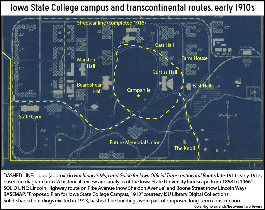
The route that was adopted in 1913 as Iowa’s portion of the Lincoln Highway had been mapped for Huebinger’s Map & Guide for Iowa Official Transcontinental Route in 1911. In Ames, that guide took travelers through Iowa State College of Agriculture and Mechanic Arts. Not past, not around, through.
“Tourists are invited to make an examination of the College Buildings and Grounds. Every courtesy will be shown them,” says a full-page promotion for the college in the guide.
The Transcontinental route entered Story County from the west through the unincorporated community of Ontario. Today that area, around the intersection of Ontario Street and North Dakota Avenue, is part of west Ames. From Ontario Street the route turned south onto Hyland Avenue and what then was Pike Avenue.
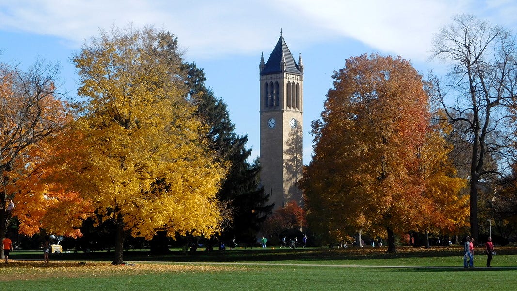
A traveler in 1914 coming into ISC from the west would not have seen the four pillars donated by classes of the 1920s, but would have seen the brand new State Gym. There would have been a drivable loop around Central Campus, with sights of the Campanile, two buildings not yet a decade old today known as Beardshear Hall and Curtiss Hall, and a slightly older building then called Agricultural Hall and now Catt Hall. The roads of the early 1910s did not quite match the streets or sidewalks of today. Diagrams in a 1966 graduate dissertation by Robert William Werle on the landscape architecture history of campus provide guidance for reconstructing the layout of the time.
The Transcontinental got from the loop to Boone Street by way of Knoll Road, which in the 21st century was renamed as an extension of Union Drive. Boone Street existed along the south side of the campus, but erosion from College Creek made it troublesome for drivers. Eastward, the campus was connected to the main part of Ames by Boone Street and a streetcar line, with half a mile of flood-prone swamp in between. In the 1970s, part of that area became the Iowa State Center — Hilton Coliseum, C.Y. Stephens Auditorium, Fisher Theater, and the Scheman Building — and Jack Trice Stadium. Hilton has been flooded up to the corner scoreboards twice, in 1993 and 2010.
Two of the oldest highway plans online in the Iowa Department of Transportation archives are from 1913 for the “Iowa Post Road.” They cover the Lincoln Highway route from the Story/Marshall county line to Boone, including a railroad underpass east of Nevada that would be finished in the fall of 1917 and remains to this day.
Newspaper coverage indicates the Post Road was completed in the second half of 1913, right when the Lincoln Highway was dedicated. The February 1914 official Iowa State Highway Commission map of Story County is inconclusive on the route in the college area because highways were not marked inside city limits. By April, though, there seems to be an answer:
“Lincoln Way” new name of streets
“Lincoln Way” is the newest street in Ames and this name is applied to a part of what used to be Boone street, Pike avenue, a part of Ontario street and the unnamed road west from Ontario street to the city limits. ...
Last year the city voted to donate $1,000 toward the improvement of the Lincoln highway. As funds were not available at that time the city treasurer paid the $1,000 out of his own pocket. Tuesday evening the council ordered the treasurer to pay himself.
— Ames Weekly Tribune, April 23, 1914
There’s one remaining wrinkle. On the same day as the renaming article, the Tribune reported the Iowa attorney general was going to court to stop the Story County supervisors from taking land on campus to widen the road. “While the college authorities will not object to light traffic passing over the road within the campus, they will object to heavy traffic and the driving cattle through the property.” (Cattle?!) Two months later, an agreement was made “that the state would make repairs on Lincoln Way abutting the campus on the south to make the road safe for travel.”
In conclusion, it’s unlikely that the Lincoln Highway had a campus loop, but even if so, it lasted months at most. Ames was “sadly negligent” in marking the road until late 1914, so no one would have seen painted poles there.
In 1942, the “Lincoln Way” name was removed from the streets west of campus and placed on the remainder of the street going straight west to Boone, which had become U.S. Highway 30 when it was paved in 1930.
Five decades after the Post Road was built, Lincoln Way was expanded to four lanes through the campus area, but traffic remained unbearable. After another decade the U.S. 30 freeway opened, taking it miles away from Iowa State University.
A Lincoln Highway marker remains at the southeast corner of Lincoln Way and Beach Avenue. The north-south road that goes from Hamilton Hall to Reiman Gardens was previously Beech Avenue and renamed for professor Spencer A. Beach on Sept. 19, 1961.
For more about the Lincoln Highway in the city of Ames itself, read the Iowa Lincoln Highway Association’s “A Tour of the Lincoln Highway in Ames, Iowa” from 1998.
My other work can be found on my website, Iowa Highway Ends, and its blog.
I am proud to be part of the Iowa Writers’ Collaborative. If you’re interested in commentary by some of Iowa’s best writers, please follow your choice of Collaborative members:


