Part of an intermittent series.
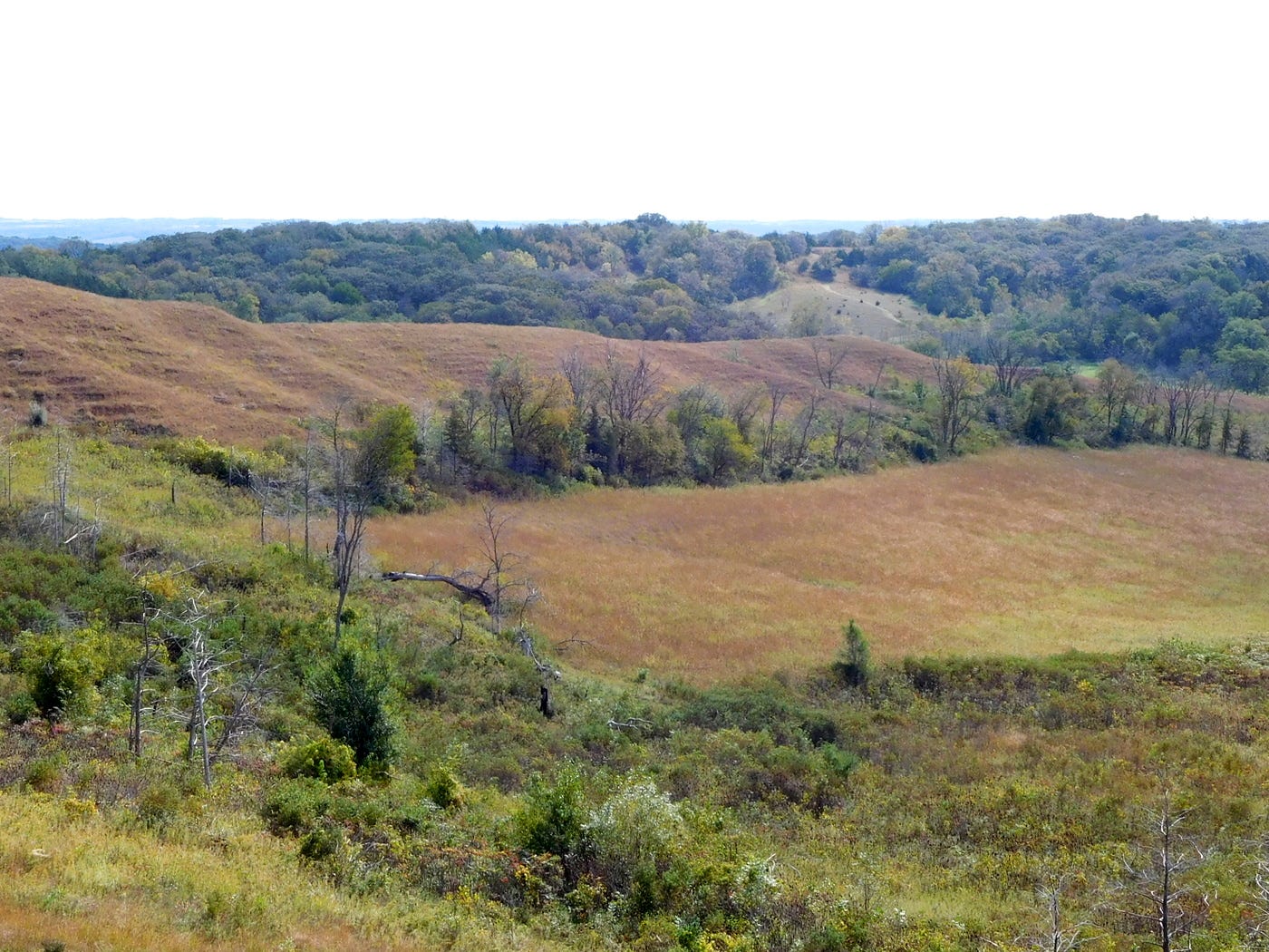
When you look at a topographical map, it is extremely easy to see where the Loess Hills end and the wide Missouri River valley and floodplain begin. Roads that run northeast/southwest, like Iowa highways 31, 175 and 183, follow smaller rivers (the Little Sioux, Maple and Soldier, respectively). Farther south, Iowa Highway 183 hugs the edge of the hills. It only takes an hour and a half on I-29 to get where I wanted to go, but on this circumnavigation trip, I wanted to experience the hills.
Here’s a bit of highway trivia leaving Sioux City: U.S. Highway 75 started out using Lakeport Road on the southeast side of the city. Lewis Road, later Lewis Boulevard, became the route in 1934. U.S. 75 replaced the “King of Trails” auto route, which ran from Winnipeg to Galveston. Minnesota does a good job of promoting the King of Trails’ history.
Southward to Onawa, a ramrod-straight diagonal that paralleled the Chicago & North Western Railroad was paved in 1924. Eventually I-29 would be built along the same corridor. U.S. 75 between Sioux City and Council Bluffs was shifted to the Nebraska side in 1984, compressing US 73 to a highway barely over 100 miles today.
Between the time of my 2015 trip and today, Whiting’s school building reached the century mark. In 2022-23, Whiting was the third-smallest district in Iowa to have a high school and the smallest not to send high school students elsewhere for at least part of the day.
It was 18 miles from Whiting to Castana, with a noticeable change in scenery between the two. The only youths at the closed Castana school, though, were some kittens following their mother.

My visit to the Loess Hills Scenic Overlook coincided with preparations to install a marker honoring the man credited with creating the Loess Hills Scenic Byway. Walter Ordway drowned in November 2014 trying to save his dog. His body was recovered the following March, and a memorial service was held a few months later.
“This location at the Loess Hills Forest Overlook was called ‘The Spot’ by Walter as a salute to the land he called home,” the marker reads. The Spot is great. I had the overlook to myself and took a little time to appreciate the view.
When it was time to eat, I had no choice but to stop at the “Old Home Filler-Up An’ Keep On A-Truckin’ Café” in Pisgah.
Unlike in Doon, I had some company as I ate my hot beef sandwich and potatoes. There was a couple who apparently also had the idea to travel the Loess Hills because we’d run into each other again later. Also in Pisgah is the Loess Hills State Forest visitor center. It has some neat stuff about the history and composition of the hills.
Modale has an old school that closed at the same time as Pisgah, in 1995, when the West Harrison school district finally consolidated its facilities in Mondamin. The district had attempted to do that five times in a decade (1975-84) but voters would not approve a bond issue until 1993.
Just south of U.S. Highway 30 is the DeSoto National Wildlife Refuge Visitor Center. There is a $3 entrance fee. At the visitor center I watched a film about the refuge, again ran into the couple I’d met in Pisgah and then viewed the collection from the steamboat Bertrand, which hit a snag (dead tree) in the river and sank. A U.S. Fish and Wildlife Service pamphlet explains the collection’s importance:
When the Bertrand sank, in April 1865, the Missouri River quickly covered the boat and its cargo in mud, creating a time-capsule of Civil War-era material. In 1968 the sternwheeler was discovered on the refuge and unearthed the following year. The cargo contained all manner of goods needed for the new Montana Territory gold mines, logging camps, farms, and households. Aside from tools and equipment, even food and clothing were recovered from the boat. These items, and more, are on exhibit in the Visitor Center. Visitors may also view the excavation site where the Bertrand’s hull still lies buried.
DeSoto Lake is the second-most-famous oxbow lake, a piece the Missouri River left behind, between Iowa and Nebraska. The land inside the oxbow, but east of the Missouri River, is part of Nebraska. There is even a small “Entering Iowa/Nebraska” sign. I drove around the refuge but the wildlife appeared to be on vacation, save for one deer. I stopped at the site of the Bertrand discovery and read the informational board there. The road connecting the south end of the refuge to I-29 used to be Iowa Highway 362.

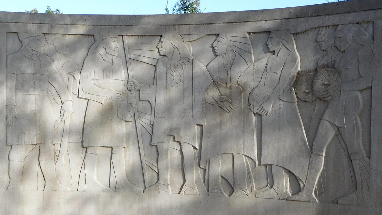
The Lewis and Clark Monument is not necessarily easy to get to, but it’s worth it. The large monument commemorates the Corps of Discovery’s meeting with Oto and Missouri tribal leaders 20 miles north of here in 1804. It’s this area that became known as Council Bluffs. Today, the monument site has a view of the Missouri River and Omaha’s Eppley Airfield.
The last stop of the day was the Bob Kerrey Pedestrian Bridge, which opened in 2008. The Iowa DOT says it’s one of the longest pedestrian bridges ever built. In the middle, an engraved line lets walkers and cyclists know where to straddle Iowa and Nebraska.
Because this was a trip about Iowa, I wanted to spend each night in Iowa. It was only appropriate, then, that I spent the night in one of the most famous technicalities of American geography: the town of Carter Lake, on the west side of the Missouri River but flying the Iowa flag high.
Incorporated communities visited: 8, 0 new; 65 total
My other work can be found on my website, Iowa Highway Ends, and its blog.
I am proud to be part of the Iowa Writers’ Collaborative. If you’re interested in commentary by some of Iowa’s best writers, please follow your choice of Collaborative members:


Love the Loess Hills!