Around the state in 8 days: Day 4
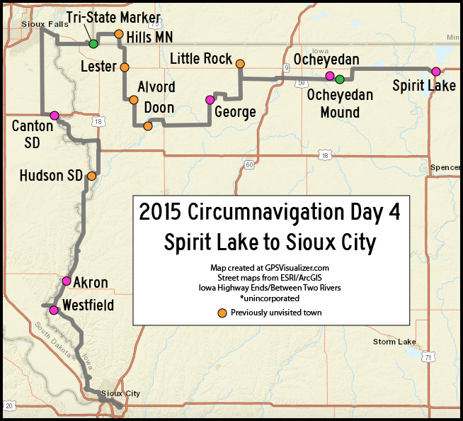
Spirit Lake to Sioux City, while going up and down in Lyon County
Part of an intermittent series.
This day on my 2015 circumnavigation tour was into the northwest corner of Iowa, touching two other states and being within sight of a third. It also included the second state marker of the trip.
The not-highest point in Iowa
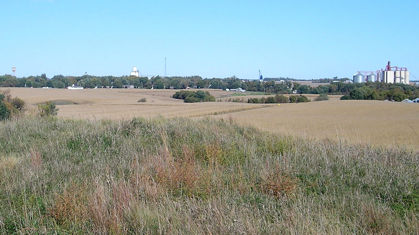
Ocheyedan Mound is a kame, made of material left behind by a glacier. The Ocheyedan centennial book, transcribed online, has a history of the mound, including previous misconceptions about its origin. The history also mentions the biggest misconception of all — the thought it was the highest point in Iowa.
In 1971, the U.S. Geological Survey found the mound had lost ground. It was 60 feet shorter than previously noted, the Des Moines Register said. After an extensive survey of Osceola County, a new high point was designated. It was in a hog lot of the Merrill Sterler farm north of Sibley. The new location meant that “agriculture is the real high point,” then-Iowa Gov. Robert Ray told the Register in 1974. The site remained undeveloped until 2008, when Osceola County acquired seven acres of the farm and turned it into a roadside stop. A side effect of the survey project was a large demotion of the land at Pilot Knob State Park in Winnebago County. At least as recently as 2016, a sign there deemed it Iowa’s second-highest point. However, the park is 100 feet lower in elevation than the entire town of Ocheyedan.
On the day of my visit to Ocheyedan Mound, white rocks on it were arranged to spell “G-LRS,” presumably for the George-Little Rock school district. The mound is in the Sibley-Ocheyedan school district, so someone was having some good-natured fun.
Outside George-Little Rock Elementary in Little Rock, a marching band was practicing on the street. The city is named for a “little” branch of the Rock River.
An old highway and an older marker
In George, I stopped at City Hall to see if I could find information about the end of Iowa Highway 339, which served this town from 1936 to 2000. After some digging into available materials, the staff and I found the answer behind us. On the city map posted on the wall, “IA 339 End” was clearly marked on Virginia Street at Michigan Avenue, east of downtown. You never know where information will turn up! Further research later revealed that before 1990, the highway had turned west on Michigan and gone into downtown, ending right outside the building we were in.
Doon would be my meal stop for the day. I was one of the few people inside the Corner Cafe, where I had a standby that hit the spot: A pizza burger and cheese balls.
The 1941 school building in Doon, across the street from the cafe, was being used as the library. In mid-2021, the city began a campaign to replace the building with a new community center. Voters approved a municipal bond in March 2023. The facility, with an estimated cost of $2.7 million, will have a groundbreaking this year, the N’West Iowa Review reports.
I turned north for 20 miles through Alvord and Lester. Lester’s city limits are technically just off Iowa Highway 9. If you pull off the road and walk into Keith’s Korner, where there was a large cutout poster of West Lyon alumnus and former Detroit Lions player Kyle Vanden Bosch, you’ve entered Lester.
Hills is the southwesternmost town in Minnesota, two miles north of the Iowa line. I saw what appeared to be a well-maintained school with no cars in front of it — an oddity for a fall weekday — and stopped at City Hall to see if I could find out more. The clerk was glad to explain. Citizens in the Hills-Beaver Creek school district, she said, believe in strong small schools, and the pre-World War II building was “nickel-and-diming” them. A new school on the northwest corner of town opened in 2011, but the 2005 gym and locker rooms at the original site were still being used, she said.
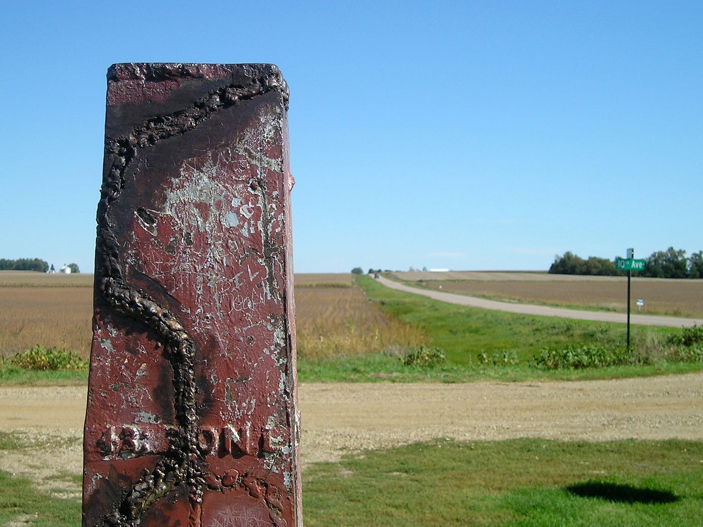
There are six locations where Iowa has a border junction with two other states, but only one is on land: The triple point with Minnesota and South Dakota. The marker is in the South Dakota corner; the spot is in the middle of the road.

The original 1859 iron marker was rededicated Oct. 9, 1938, after repairs. The Lyon County Reporter said a time capsule was included and a photo shows a fence around the marker. For the next 40 years it was in the middle of the road. In 1980 the marker was placed at its current location, the South Dakota corner, with a large concrete base and new plaque.
Bobbing and weaving down the western edge
From the Tri-State Marker, it’s 7 miles west to Iowa’s northwest corner, and 5 more miles to Sioux Falls’ extending environs. In my multiple crossings of the border to the south, I passed through Hudson, South Dakota, which a small sign bills as “home of Amanda Clement, the first paid woman baseball umpire.”
The Loess Hills National Scenic Byway begins in Akron and there’s a Loess Hills Interpretive Center in Westfield. How far west is Westfield? It’s farther west than Tulsa and Houston, and almost as far west as Dallas.
South of Westfield to Sioux City, I took the gravel Loess Hills Scenic Byway Ridge Road route. I was treated to beautiful views of crop fields that had been harvested or were soon to be so.

I took a loop through Stone State Park, then took pictures of the Military Road bridge into North Sioux City, South Dakota. This was the main connection across the Big Sioux before I-29 was built, and where US 77 left Iowa. Construction on I-29 created a delay in a visit to Larsen Park and the Flight 232 memorial with the “Spirit of Siouxland” statue.
Incorporated communities visited: 12 in Iowa, 4 new (Little Rock, Doon, Alvord, Lester); 57 total
My other work can be found on my website, Iowa Highway Ends, and its blog.
I am proud to be part of the Iowa Writers’ Collaborative. If you’re interested in commentary by some of Iowa’s best writers, please follow your choice of Collaborative members:


As a native of NW Iowa, I loved this. It was only after I left that I realized the treasure that is the Loess Hills. Thanks!